


On Day 2 of this cross-country cookie trip, we’re heading south of Historic Jamestowne about 190 miles to Cape Hatteras National Seashore. Stretching along North Carolina’s Outer Banks (OBX) from Bodie Island to Okracoke Island, Cape Hatteras is a beach lover’s dream.

It’s also the first national seashore in the National Park System (designated in 1937 and established in 1953). OBX locals, fearful of beach houses popping up, worked with the National Park Service in the mid-1930’s to protect and preserve the land and its natural resources. Now it’s a seventy-mile stretch of beaches and barrier islands we can all enjoy for years to come. The endangered loggerhead sea turtle definitely benefits from this!


Long before the murderous pirate Blackbeard and watchful lighthouse keepers stood on its shores, the Outer Banks was home to groups of Algonquian and Iroquoian-speaking peoples. Their daily lives were similar to the Powhatan peoples to the north–fishing, hunting and farming. However their governing systems varied. The Colington Algonquians had a central chief like Powhatan, but the Cashie tribes of the Inner Coastal Plain were all independently run. Ultimately, the fate of these native tribes is unknown. Historians believe diseases carried by European colonists wiped out native populations. Those who remained may have assimilated into the European, African, and inland native populations. More detailed information about the various OBX tribes can be found here.


Besides amazing beaches and outdoor activities, the Outer Banks lighthouses and stations are prominent features. They are, after all, why I dragged The Hubby and Sons A & B down there years ago. The OBX along North Carolina’s coastline is notorious for swift currents, shoal water, and treacherous storms. It has definitely earned it’s reputation as the “Graveyard of the Atlantic.” As of 2006, underwater scanning equipment projected shipwreck estimates in this area at about 2,000 vessels. This figure, however, doesn’t include the centuries of sea-farers before who vanished into the Atlantic’s abyss.

Bodie Lighthouse 
Cape Hatteras Lighthouse 

Today’s black and white striped Cape Hatteras lighthouse hasn’t always looked like it does today, nor has it been in the same location. The U.S. Congress, in 1794, realized valuable cargo ships were being lost off a particularly rough stretch of North Carolina coastline called Diamond Shoals. Construction of a 90-foot tall, sandstone lighthouse began in 1799, and was lit with whale oil in October 1803. (Illustration Credit: ©Mike Litwin)

By 1853, the original 1803 Cape Hatteras lighthouse wasn’t shedding any light on the sinking situation; and was in fact making navigation worse. Its sandstone color blended in with the beach environment. The lamp was simply too short and too weak to see. Something had to change. The Lighthouse Board recommended an additional 60-feet be added to the top of the existing structure. It’s top was painted red to stand out during the day, and a new order Fresnel lenses replaced the whale oil lamp. By 1860, the 1853 Cape Hatteras lighthouse was falling into disrepair. Unfortunately, the Civil War was beginning to rage. (Illustration Credit: ©Mike Litwin)
At the start of the Civil War and throughout it, North Carolina was a part of the Confederate States of America. After initial shots were fired on Fort Sumter in April 1861, President Lincoln ordered a blockade of southern ports and sent a hodgepodge group of Union Navy vessels to barricade the Rebel coastline. This sent the Confederates into over-built as they scrambled to construct Fort Clark and Fort Hatteras on Hatteras Island’s southern end. Some 700 troops from the 7th North Carolina were sent to man the forts. The Rebels had to protect their interests and the inland Pamlico and Albemarle waterways.

Unfortunately or fortunately, the rag-tag group of Union ships fell victim to the Confederates pillaging. Sixteen merchant vessels were captured by the beginning of August 1861. Despite being prisoners, captured Union officers and crews were given unsupervised, free-range of Hatteras Island and it’s unfinished forts. Southern hospitality turned into espionage and upon release, these now-turned Union spies spilled their secret information to their superiors.
By August 28, 1861, the Union navy led by Flag Officer Silas Stringham had five well-armed Union frigates and two gunboats in position near Fort Hatteras. African Americans sailors made up a gun crew on board the flagship Minnesota. As another wave of attack, 900 infantrymen led by Major General Benjamin Butler waited. In a coordinated amphibious attack (the first of its kind during the Civil War), the Union forces surprised the ill-prepared and ill-equipped Confederate forces at Fort Hatteras and Fort Clark. Ultimately, the Union gained control of both forts and shipped the Rebels off to prison. History knows this as the Battle of Hatteras Inlet. (1)

At the time of the battle, it’s believed there were approximately 200 enslaved African Americans working within nearby Fort Roanoke on Roanoke Island. After hearing about the Union victory at Fort Hatteras, they and others from the surrounding area escaped to its safe haven. To accommodate the large numbers of fleeing “contraband” peoples, the Union converted a former Confederate building into a barracks dubbed the “Hotel d’Afrique.” (2). By 1864, Hotel d’Afrique mushroomed into a series of 12 wooden barracks, housing some 2,700 freedmen and women.

Realizing the Union forces wouldn’t return them to bondage, enslaved people overwhelmed other Union controlled islands. Roanoke Island eventually became a designated “contraband camp” named the Roanoke Island Freedmen’s Colony. Newly freedmen and women lived, worked for the Union, and received an education while there.
Standing watch in disrepair over all of this action was the 1853 Cape Hatteras lighthouse. Sometime in 1861, the Confederates tried to tear its structure down, but Union forces kept it intact except for the Fresnel lenses. With the Civil War and its exhaustive budget behind them and plans in hand, Congress approved $75,000 for construction upgrades to start in October 1868.


Measuring 198.49 feet from the bottom of its foundation to the top of it pinnacle, and 257 steps to the balcony, the renovated Cape Hatteras lighthouse was put back into operation on December 16, 1870. The final cost to build it was over budget, totaling $167,500. Ouch! The lighthouse’s iconic black and white daymark and nightmark pattern was painted on its brick structure in 1873. It remains the tallest U.S. lighthouse in operation to this day.
By 1935, beach erosion threatened the stability of Cape Hatteras lighthouse and it was decommissioned by the Bureau of Lighthouses. The National Park Service acquired it and its surrounding buildings in 1937 when Cape Hatteras National Seashore was designated. Up until 1950, the light remained dark. Eventually, the beach was built back up and a newer beacon was placed into the tower by the U.S. Coast Guard. Despite decades of beach erosion stabilization, In 1999, after years of study and debate, the Cape Hatteras Light Station moved to its current place. Taking 23 days, the lighthouse was moved 2,900 feet; and lies 1,500 feet from the seashore, its original distance from the sea. The two Principal Keeper’s and Double Keepers’ Quarters, the dwelling cisterns, and the oil house were all relocated with the lighthouse to their original location from the lighthouse. (3). Through a joint effort today, the National Park Service maintains the support buildings and lighthouse proper; while the U.S. Coast Guard operates and manages the automated light beacon in the tower.


These bricks are on Cape Hatteras lighthouse’s original location. You can see it’s current location in the distance–2,900 away.
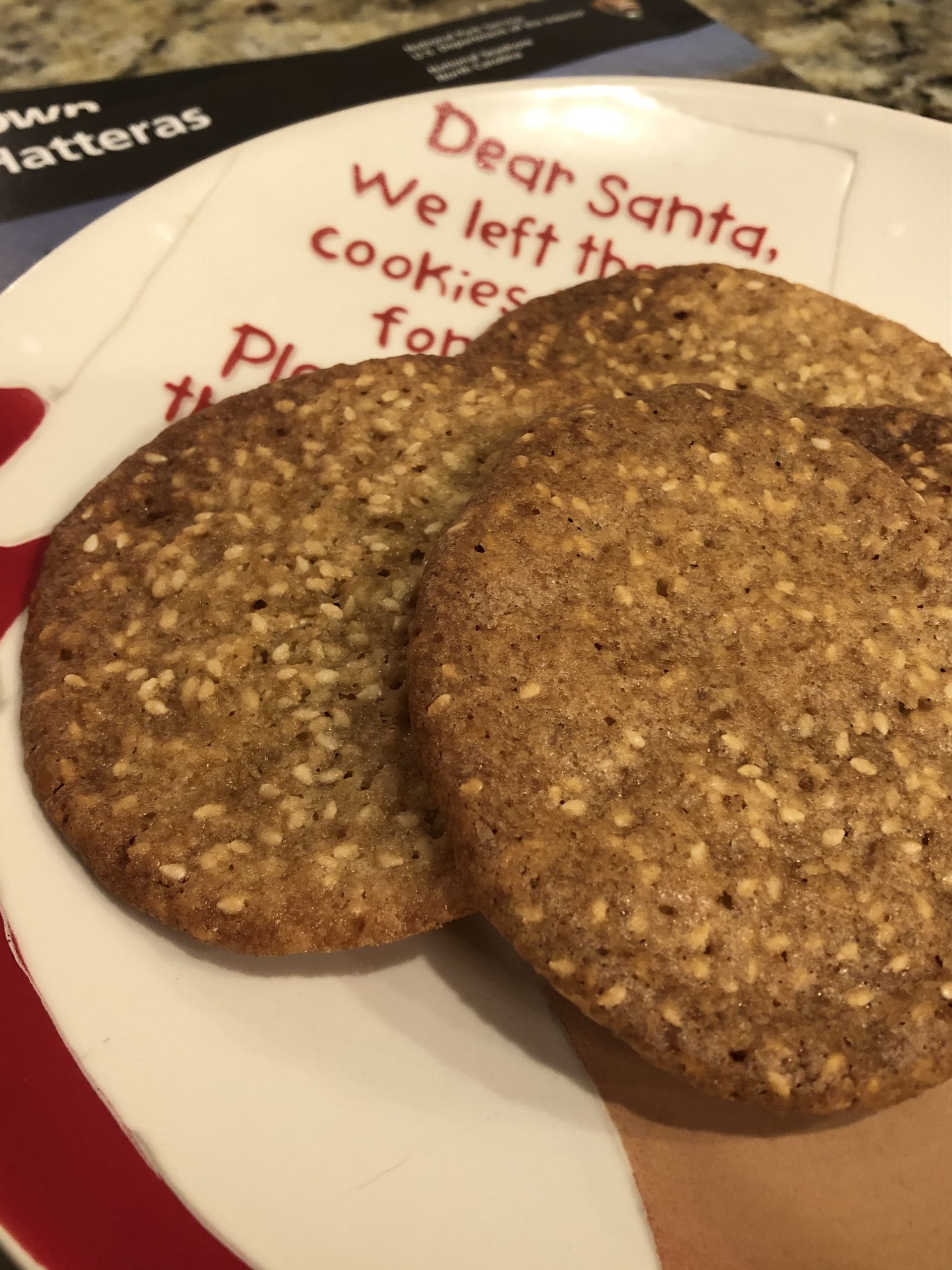
Day 2’s cookie is the Benne Wafer. I’ve chosen this particular one to honor the Minnesota’s African American gun crew; and the freedmen and women who found newfound liberties at the Hotel d’Afrique on Hatteras Island. But what’s a benne?
During the 17th Century Atlantic slave trade, enslaved Africans from the sub-Saharan region brought benne seeds to the Americas with them. Benne seeds are sesame seeds. Predominantly found in South Carolina’s Lowcountry, benne seed cookies became a traditional southern offering to guests. Eating sesame seeds are considered to be good luck. With 2020 wrapping up, maybe we need to eat a lot of these?!

Technically a seed, sesame seeds can be toasted like a nut, giving off an almond or peanut aroma and taste. They’re extremely high in protein, while conveniently void of cholesterol. Cultures in the Middle East, Asia and Mediterranean countries make sesame seeds a key ingredient in their cuisines. In the U.S., we commonly use them on sandwich buns.
The recipe I’m featuring and using comes from What’s Cooking America. But according to the website’s author, this recipe is a variation from the cookbook America’s Best Lost Recipes, by The Editors of Cook’s Country Magazine. Cooking is just a continuous tweaking of recipes and rediscovering long-lost favorites!

For this recipe, I highly recommend using a melon baller or small ice cream scooper to evenly portion out the sticky dough. Give the dough ample amounts of space to spread out…anywhere from 2-1/2 to 3-inches in between dough balls. As it cooks, the dough flattens out into an extremely thin pancake, thus the wafer. Leaving enough space in between the wafers will ensure you don’t end up with Mickey Mouse head shaped cookies. (Using parchment paper with a grid pattern also helps too.)
Continuing on with the Civil War, we’ll be advancing Day 3’s travels to Gettysburg National Military Park in Pennsylvania. I think I’ll stuff a haversack full of Benne Wafers for tasty luck!
PrintBenne Wafers

Thin, crispy, and nutty, Benne or sesame wafers are a delicate tasty token of Southern hospitality and good luck. A little good luck never hurts anyone!
Adapted from What’s Cooking America’s Benne Wafer Cookie Recipe.
- Prep Time: 15 Minutes
- Cook Time: 8 to 9 Minutes
- Total Time: 24 to 25 Minutes
Ingredients
1/2 cup all-purpose flour, sifted
1/2 tsp. baking powder
1/4 tsp. salt (kosher, table or sea)
6 tbsp. unsalted butter, at room temperature
3/4 cup brown sugar, lightly packed
1 large egg, at room temperature
1/2 tsp. vanilla
1/3 to 1/2 cup white sesame seeds, toasted*
Instructions
Preheat oven to 325 degrees f. Line a baking sheet with parchment paper, Silpat liner or grease.
Combine flour, baking powder and salt in a medium-sized bowl. Set aside.
Using a standing or hand-held mixer, beat the butter and brown sugar until light and fluffy. Scrape down the bottom and sides of the bowl as needed. Beat in the egg and vanilla until combined. Add flour mixture and beat until evenly incorporated. Stir in the cooled sesame seeds.
Drop heaping teaspoonfuls of dough on to the prepared baking sheet, 2-1/2 inches apart. (Using a small ice cream scoop or melon baller helps ensure cookies are evenly portioned.). The dough will spread out into a thin pancake shape. Bake for 8 to 9 minutes, or until cookies bubble and the edges are golden brown.
Remove baking sheets from the oven and allow cookies to cool on the sheet for about 2 minutes. Transfer cookies to a wire rack to cool completely. Moving warm cookies will cause them to break apart. Store in an airtight container.
Notes
*Preheat the oven to 275 degrees F. Place sesame seeds on a baking sheet and bake for 3 to 4 minutes, or until golden and fragrant. Watch closely to avoid burning.
IMNPB
Recommended To You


